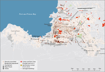
Grahic visualisation of different informations based on maps of charity institutions, various studies and text. Overlapping the individual layers, the different information can be compared and analyzed for dependencies.
 |
| Spontaneous camps (15.01.2010), long-term camps (Google Earth 2011) and hospitals |
 |
| Spontaneous camps (15.01.2010), long-term camps (Google Earth 2011) and collapsed buildings |
 |
| Camps and tent cities (Google Earth 2011), neighborhoods and industrial areas |
 |
| Camps and tent cities (Google Earth 2011), power plants, international bases, damaged infrastructure and landslides |
 |
| Camps and tent cities (Google Earth 2011), analysis of flood risk |
Keine Kommentare:
Kommentar veröffentlichen